Patna, the capital city of Bihar, is all set to get its first modern metro rail service. The Patna Metro Project, under the Delhi Metro Rail Corporation (DMRC) and Bihar government, is under construction and will soon transform the way people travel in the city. To make travel easier in the future, here we are sharing the Patna Metro Map in Full HD with the latest details of routes, lines, and stations.
What is Patna Metro?
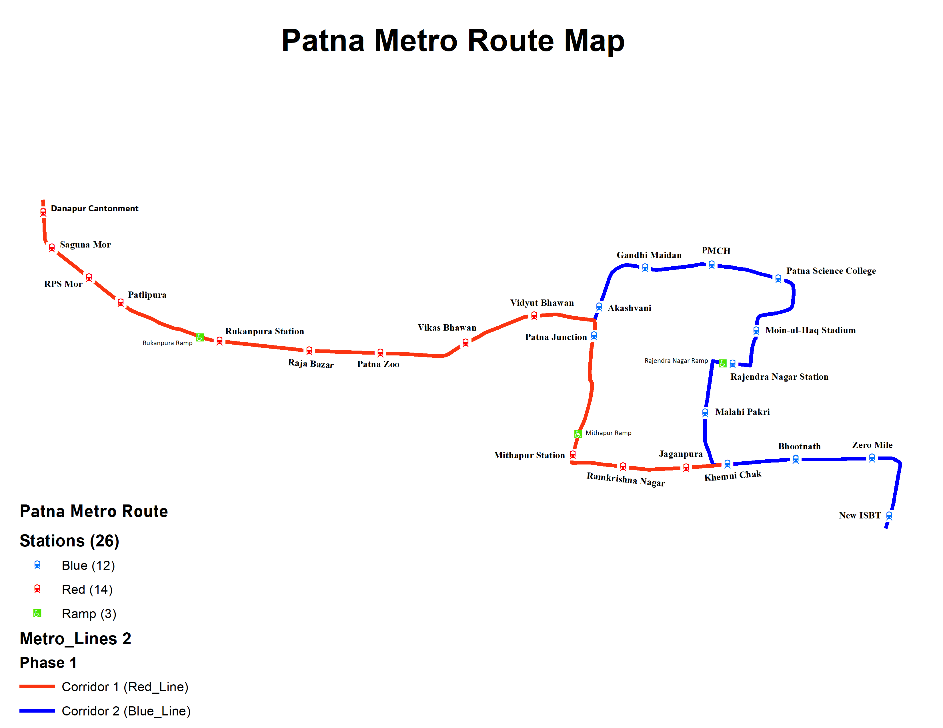
Patna Metro is a rapid transit system designed to provide fast, affordable, and eco-friendly transport for the people of Patna. The project will connect major areas like Danapur, Mithapur, Khemnichak, Rajendra Nagar, and Patna Junction.
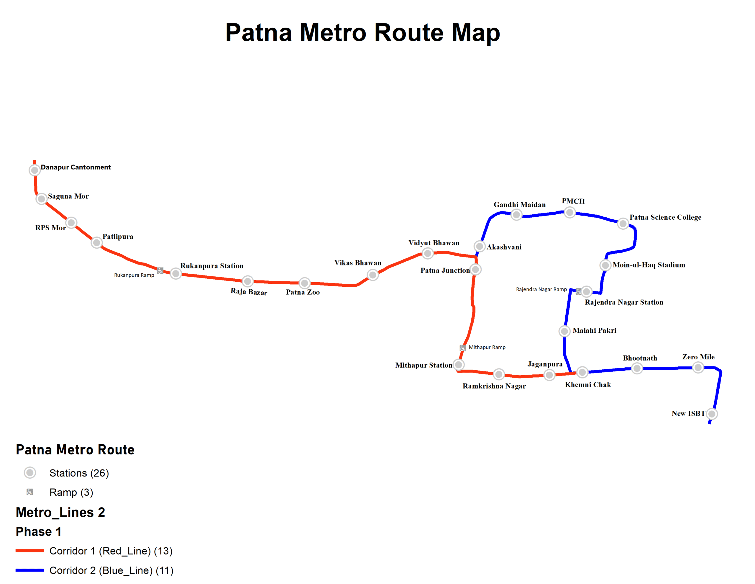
The Patna Metro is a rapid transit system under construction in Patna, Bihar. The network includes two corridors, each with multiple stations serving key areas across the city.
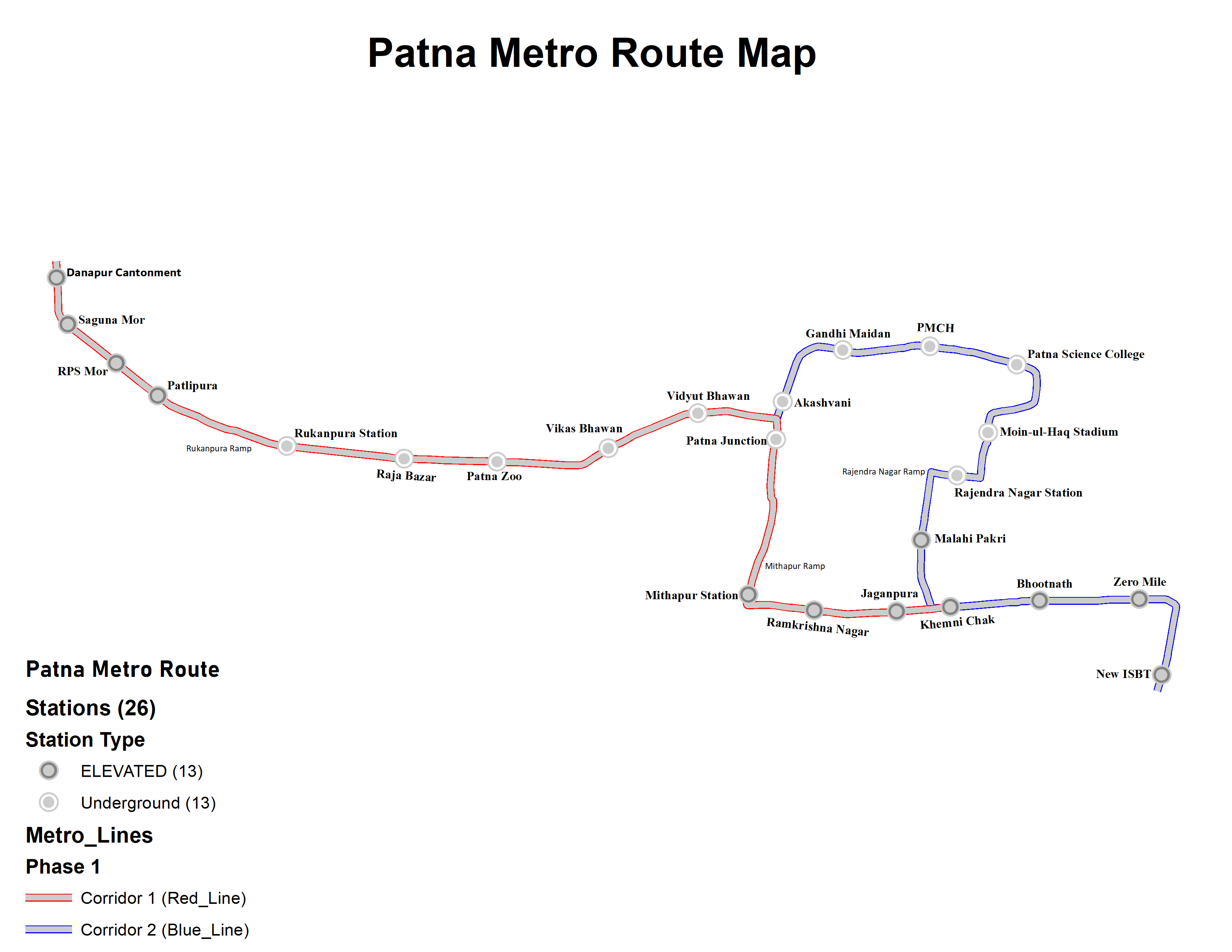
Corridor 1 (Red Line) East-West Line
- Route: Danapur Cantonment to Khemni Chak
- Length: 16.86 km
- Stations: 14
- Danapur Cantonment
- Saguna More
- RPS More
- Patliputra
- Rukanpura
- Raja Bazar
- Patna Zoo
- Vikas Bhawan
- Vidyut Bhawan
- Patna Junction
- Mithapur
- Ramkrishna Nagar
- Jaganpura
- Khemni Chak
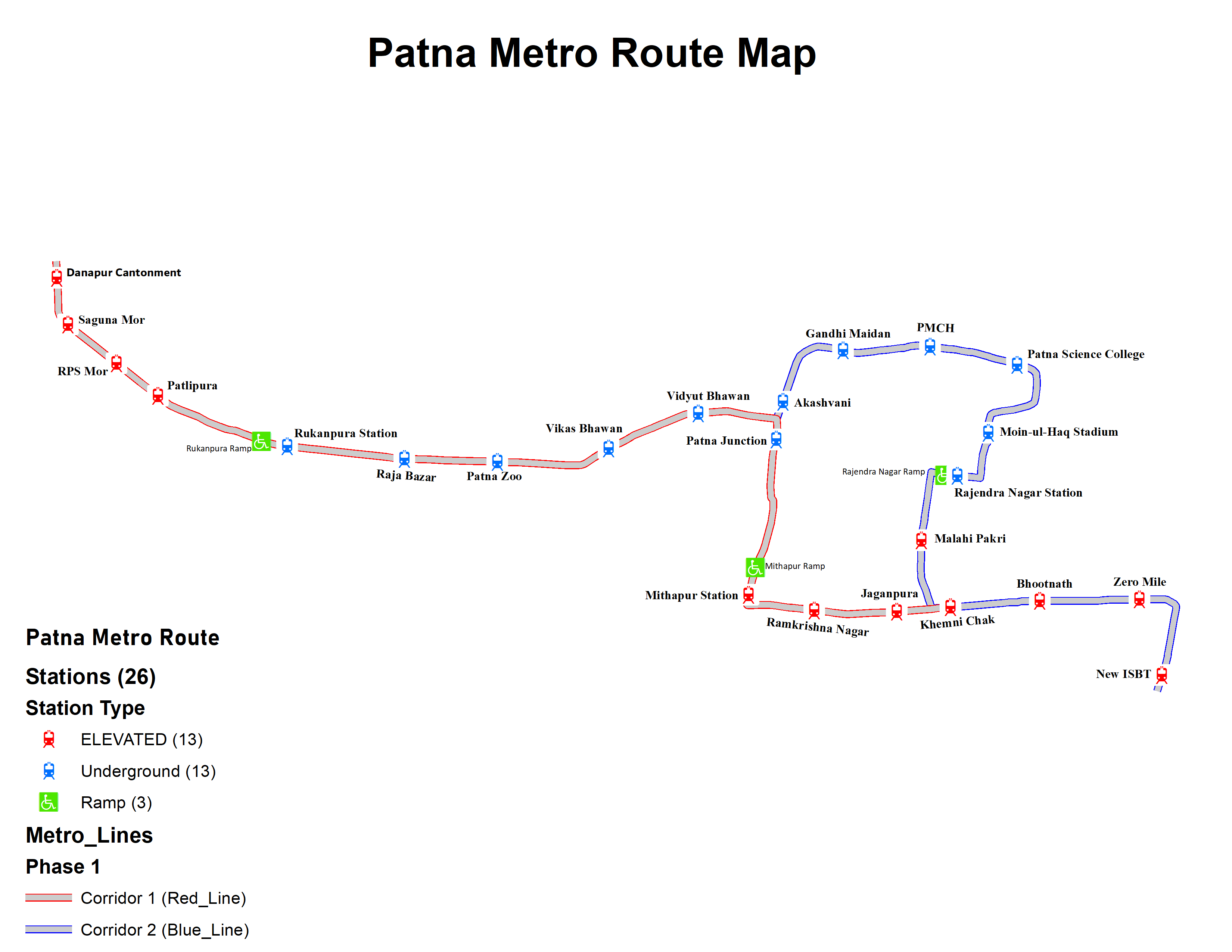
Corridor 2 (Blue Line) North-South Line
- Route: Patna Junction to New ISBT
- Length: 14.06 km
- Stations: 12
- Patna Junction
- Akashvani
- Gandhi Maidan
- PMCH
- Patna University
- Moin-ul-Haq Stadium
- Rajendra Nagar
- Malahi Pakri
- Khemni Chak
- Bhootnath
- Zero Mile
- New ISBT
Legend: Elevated | Underground | Interchange Station
Patna Metro 2025
| Feature | Details |
|---|---|
| Project Type | Rapid Transit Metro Rail |
| Total Metro Lines | 2 (Corridor 1 and Corridor 2) |
| Total Stations | 24+ planned stations |
| Coverage Area | Danapur – Mithapur – Khemnichak – Patna Junction – ISBT |
| Expected Completion | Phase 1 by 2027 |
| Map Format | Full HD (High Definition) |
Patna Metro Map Full HD
The Patna Metro will have two corridors in Phase 1:
- Corridor 1 (East-West Line)
- Danapur Cantonment to Mithapur
- Approx. 17 km long with 14 stations
- Stations: Danapur, Saguna More, RPS More, Bailey Road, Rajendra Nagar, Mithapur, etc.
- Corridor 2 (North-South Line)
- Patna Junction to New ISBT (Khemnichak)
- Approx. 14 km long with 12 stations
- Stations: Patna Junction, Gandhi Maidan, PMCH, Rajendra Nagar, Malahi Pakri, Khemnichak, ISBT, etc.
You can soon download Patna Metro Map in Full HD to use on your mobile and for travel planning.
Why Patna Metro is Important?
- Traffic Solution – Helps reduce congestion on Patna’s busy roads.
- Time Saving – Faster travel compared to buses and autos.
- Affordable Transport – Metro fares will be pocket-friendly.
- Eco-Friendly – Reduces pollution by cutting vehicle emissions.
- Boost to Economy – Better connectivity means more growth for Patna city.
Benefits of Using Patna Metro Map in HD
- Shows exact route of both metro corridors.
- Easy for newcomers and tourists in Patna.
- Helps daily commuters plan travel in advance.
- Can be saved offline for future use.

How to Get Patna Metro Map in Full HD?
- Official Bihar Metro Rail Corporation (BMRC) website will provide the latest map.
- Maps will be displayed at metro stations once operational.
- Digital maps will also be available in mobile apps.
- You can save the JPG or PDF version on your device.
Conclusion
The Patna Metro Map Full HD (2025) is going to be the backbone of modern transport in Bihar’s capital. With two main corridors covering major parts of the city, the metro will make daily travel smooth, fast, and eco-friendly.