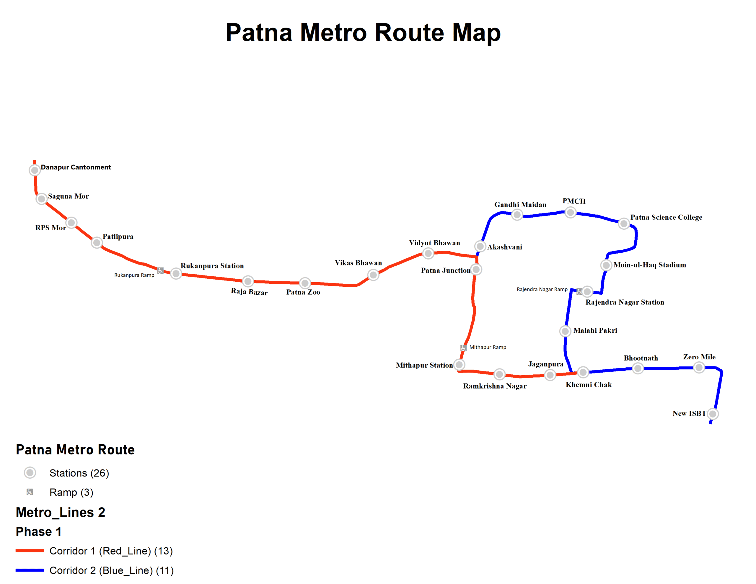
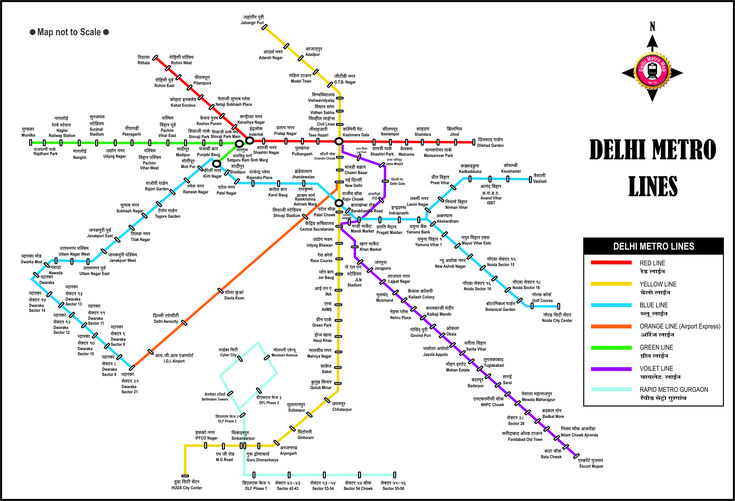
The Chennai Metro is a fast-growing rapid transit system serving India’s southern metropolis. Designed to ease traffic congestion and provide a clean, efficient alternative for city travel, the network currently spans over 54 kilometers with two major lines — Blue and Green — and more under construction.
Whether you’re a commuter, tourist, or student, understanding the Chennai Metro Map is key to saving time and planning smooth journeys.
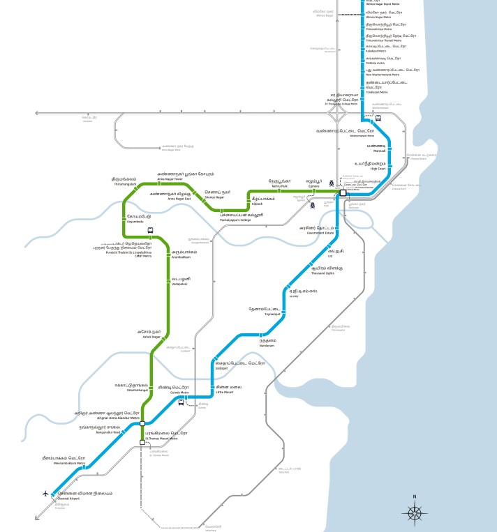
Chennai Metro Map Pdf
- Blue Line (Line 1): Wimco Nagar ↔ Airport
- Green Line (Line 2): Central Metro ↔ St. Thomas Mount
Both lines intersect at key stations like:
- Arumbakkam
- Kilpauk
- Chennai Central Metro – a major hub for city and rail connectivity
Download Chennai Metro Map PDF
Interchange Stations
| Interchange Station | Connects |
|---|---|
| Chennai Central | Blue + Green |
| Arumbakkam | Near Bus Route |
| Alandur | Key interchange for airport access |
Upcoming Lines (Phase II)
Chennai Metro’s Phase II expansion is underway, aiming to add over 118 km of new lines, including:
- Corridor 3: Madhavaram ↔ Sholinganallur
- Corridor 4: Lighthouse ↔ Poonamallee
- Corridor 5: Madhavaram ↔ CMBT
These lines will greatly improve east-west and north-south connectivity in the coming years.
Tips for Using the Metro
- Use Chennai Metro smart card for discounts.
- Trains operate approx. from 5:30 AM to 10:00 PM.
- Real-time updates and token purchases available via the CMRL app.
Why Use Chennai Metro?
- Beat city traffic
- Fully air-conditioned coaches
- Safe, secure travel
- Eco-friendly commute option
Conclusion
The Chennai Metro Map helps residents and visitors navigate the city faster and smarter. With upcoming extensions and tech-friendly services, it’s fast becoming one of the most efficient metros in India.