Delhi, the capital city of India, is not only known for its heritage and culture but also for its modern public transportation system. The Delhi Metro is the backbone of daily travel for millions of people in the National Capital Region (NCR). If you are new to Delhi or planning a visit, the Delhi Metro Map is your ultimate guide to traveling conveniently across the city. This blog will give you a complete overview of the Delhi Metro Map, routes, lines, interchanges, and tips to make your journey smooth.
Delhi-Metro-MapWhat is the Delhi Metro Map?
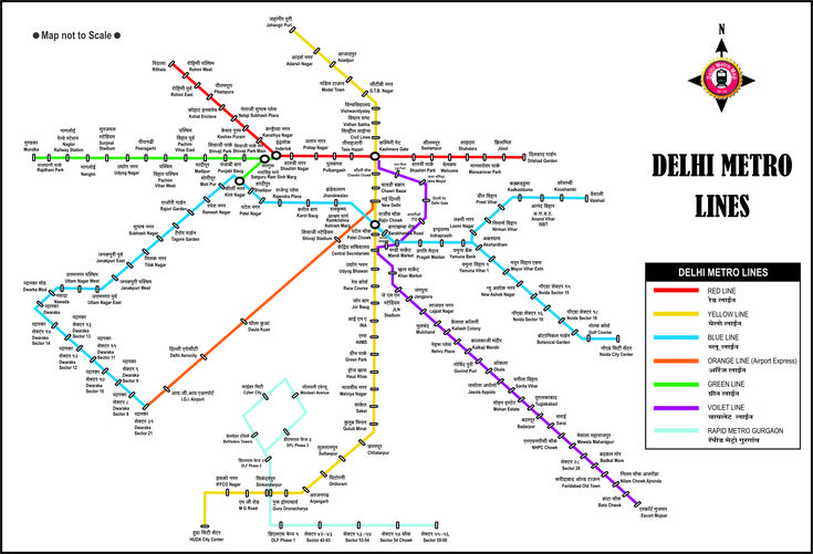
The Delhi Metro Map is a detailed chart showing all the metro lines, stations, interchanges, and connectivity routes. With more than 390 kilometers of operational network and over 290 stations, the Delhi Metro is one of the largest metro networks in the world.
The map helps passengers understand how to travel from one station to another, which line to take, and where to change trains. Whether you are a tourist visiting monuments or a daily commuter, the Delhi Metro Map is the most reliable tool to save time and money.
Overview of Delhi Metro Lines
Currently, the Delhi Metro has 10 operational lines, each represented with different colors on the map for easy identification. Below is a quick look at the lines and their routes:
- Red Line (Line 1): Rithala to Shaheed Sthal (Ghaziabad ISBT)
- Yellow Line (Line 2): Samaypur Badli to HUDA City Centre (Gurgaon)
- Blue Line (Line 3 & 4): Dwarka Sector-21 to Noida Electronic City / Vaishali
- Green Line (Line 5): Kirti Nagar / Inderlok to Brigadier Hoshiar Singh (Bahadurgarh)
- Violet Line (Line 6): Kashmere Gate to Raja Nahar Singh (Ballabhgarh)
- Pink Line (Line 7): Majlis Park to Shiv Vihar
- Magenta Line (Line 8): Janakpuri West to Botanical Garden (Noida)
- Grey Line (Line 9): Dwarka to Najafgarh / Dhansa Bus Stand
- Airport Express (Orange Line): New Delhi Railway Station to Dwarka Sector-21 (via IGI Airport)
- Rapid Metro (Gurgaon): Cyber City to Sector 55–56
Each line is color-coded on the Delhi Metro Map, making it easier for commuters to plan their routes.
Key Interchange Stations on the Delhi Metro Map
One of the most important features of the Delhi Metro Map is the interchange stations. These are the points where you can switch from one line to another without exiting the metro system.
Some major interchange stations include:
- Kashmere Gate: Interchange between Red, Yellow, and Violet lines
- Rajiv Chowk: Interchange between Yellow and Blue lines
- Hauz Khas: Interchange between Yellow and Magenta lines
- Anand Vihar ISBT: Interchange between Blue and Pink lines
- Dwarka Sector-21: Interchange between Blue Line and Airport Express Line
- Botanical Garden: Interchange between Blue and Magenta lines
Knowing these interchanges on the Delhi Metro Map makes travel faster and easier.
Why the Delhi Metro Map is Important?
The Delhi Metro Map is not just for tourists; even daily commuters rely on it for efficient travel. Here are some reasons why it is so important:
- Time-Saving: Helps you choose the fastest route
- Cost-Effective: You can compare routes and fares
- Eco-Friendly: Encourages the use of public transport
- Tourist-Friendly: Helps visitors reach monuments like Red Fort, Qutub Minar, Lotus Temple, and Akshardham easily
Delhi Metro Map for Tourists
For tourists, the Delhi Metro Map is a must-have. Most of Delhi’s historical and cultural sites are well connected by metro.
- Red Fort: Chandni Chowk (Yellow Line) or Lal Qila (Violet Line)
- Qutub Minar: Qutub Minar Station (Yellow Line)
- Lotus Temple: Kalkaji Mandir (Violet Line)
- Akshardham Temple: Akshardham Station (Blue Line)
- India Gate: Nearest metro is Central Secretariat (Yellow/Violet Line)
By following the Delhi Metro Map, tourists can save on taxi fares and explore the city with ease.
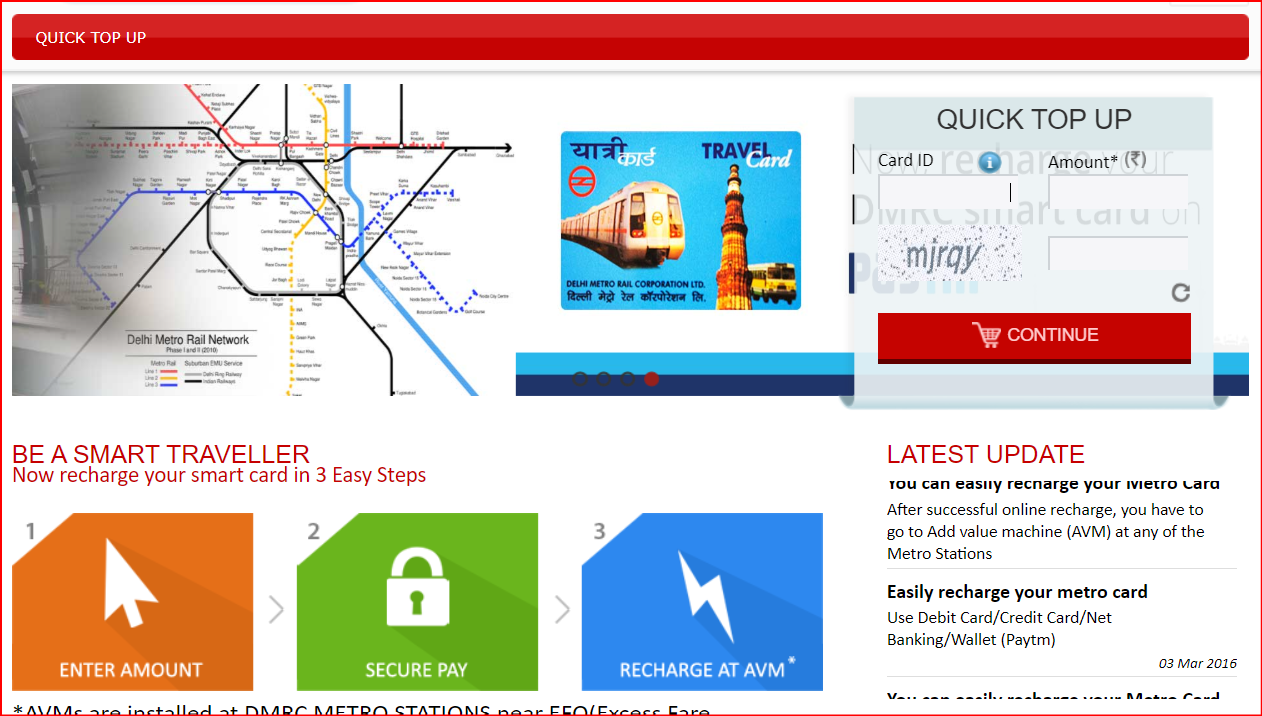
Delhi Metro Smart Card and Tokens
While the Delhi Metro Map guides your journey, you also need to understand the ticketing system.
- Smart Card: Best for daily commuters, recharged easily at stations or online
- Tokens: Single-journey tickets available at counters and vending machines
The fare depends on the distance traveled. By checking the Delhi Metro Map, you can estimate your journey length and cost.
Latest Updates in the Delhi Metro Map (2025)
The Delhi Metro network is constantly expanding. As of 2025:
- Pink Line has been extended to Shiv Vihar
- Magenta Line is fully functional between Janakpuri West and Botanical Garden
- New corridors are planned to further connect Gurgaon, Noida, and Faridabad
Passengers are advised to check the latest Delhi Metro Map 2025 for updated routes.
Tips for Using the Delhi Metro Map
- Download the official DMRC app for live updates and route planning.
- Avoid peak hours (8–10 AM and 5–8 PM) for a more comfortable journey.
- Check interchange stations before boarding to avoid confusion.
- Keep a metro smart card to save time in queues.
- Use Google Maps integration with the Delhi Metro Map for real-time navigation.
Delhi Metro Map PDF and Mobile Version
The Delhi Metro Rail Corporation (DMRC) provides a free Delhi Metro Map PDF on its official website. Mobile-friendly maps are also available, making it easier for passengers to carry the map on their smartphones.
Conclusion
The Delhi Metro Map is your key to navigating the capital city with ease. With over 390 kilometers of network, multiple interchanges, and connectivity across Delhi, Noida, Ghaziabad, Faridabad, and Gurgaon, the metro has truly transformed public transportation in NCR. Whether you are a tourist or a daily commuter, keeping a copy of the Delhi Metro Map ensures that you travel quickly, affordably, and without stress.
If you are planning to visit Delhi or are new to the city, download the latest Delhi Metro Map 2025 and explore the capital like a pro!